Route Puerto Saucillo – Peñon de los Enamorados – Torrecilla
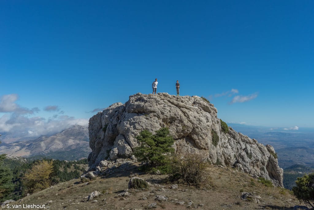
A lunar landscape in the Sierra de las Nieves
It is a lovely sunny autumn day in Malaga, ideal for a short hike in the Sierra de las Nieves (Snow Mountains) near Ronda. At the coast, it is still twenty degrees Celsius. Perfect weather to do a circular walk of 4.5 kilometres. The height of the planned route is 200 meters.
Easy-peasy.
Altiplano Sierra de las Nieves
Unfortunately, we miss the turn two kilometres into the walk. Something we only notice after an hour or two, as the route appears to be steeper and longer than expected.
Luckily there is Google to the rescue, miraculously my cell phone functions at 1700 meters altitude, even though we are in the middle of nowhere.
After googling for answers, it appears that we are on a completely different route. But, it’s okay. My much-plagued feet are doing great after a year of persistent injuries. In addition, the view of the lunar landscape is truly spectacular from the top.
Route
- Puerto Saucillo – Peñon de los Enamorados
- Distance 12 km return
- Time 4 hours
- Height difference 600 meters
Mirador Puerto Saucillo Yunquera
The hike begins at the Mirador Puerto Saucillo at 1247 meters altitude, with views of the neighbouring mountain villages; Guaro, Coin, Alhaurin, Cártama, Pizarra and Yunquera lie at our feet.
First, we hike up a steep forest path, flanked by Spanish firs or the pinsapo. This is a particular pine with needles pointing towards the trunk instead of upward.
Eight hundred meters after the start, we pass a snow well, un pozo de nieve, a traditional storehouse for snow. The snow was formerly used to cool food and drinks, a kind of large freezer.
The turn of our original route is after 1.8 kilometres, which we miss.
Peña de Cuco
After about four kilometres, we arrive at the Peña de Cuco, a gigantic boulder. From here, we have a beautiful view of the city of Malaga and the Mediterranean. After that, it is again reasonably steep upwards. Finally, we arrive at the plateau of Tolox, where the arid, barren rocks give no protection against the wind. We are not dressed for 1,700 meters altitude. The temperature here is, of course, much lower than on the coast where we came from.
Peñon de los enamorados
The weather conditions encourage us to continue a brisk walk to the next boulder. We see from afar the Penon de los Enamorados, the rock of lovers, which stands at 1780 meters.
This is the turning point. We are now six-kilometre on the road. Although the route continues to the highest point of the Sierra de las Nieves, the Torrecilla at 1914 meters altitude. But that adds seven kilometres onto the hike, so we turn around. The Torrecilla we save for next time.
Practical information
The Mirador Puerto Saucillo (google maps) is in the park Sierra de las Nieves in the village of Yunquera. From Yunquera, it is a six-kilometre drive over a steep dirt road along a bottomless abyss. The view is spectacular, but it is probably wiser to keep your eyes on the road.
At the viewpoint, there are 15 parking spaces. On Sundays and holidays, the parking tends to fill up quickly. Park your car in of the bends to the mirador.
From this viewpoint, start three routes (senderos). The route to the Penon de los Enamorados is indicated by yellow/white posts. The trail to the Torcilla can be viewed here (in Spanish).
If you are looking for a place to stay, try Castillo de Monda, a castle hotel in the nearby village of Monda.
More Sierra de las Nieves
- The chestnut trail is another great hike in the Sierra de las Nieves. Especially in the fall, because this is one of the few places in the province of Malaga where you can see autumn leaves.
- Júzcar, the ‘smurf village’ is especially entertaining with kids.
More spectacular hiking
The best of the Peak District on foot
The Peak District National Park is an amazing nature park in central and northern England. It is therefor a great place to hike, ride a horse or cycle. That is if you like steep, rocky trails.
Endless skies on the Norfolk Coast Path
Cley next to the SeaHiking the Norfolk Coast Path The 135-kilometre (84 miles) Norfolk Coast Path runs from Hunstanton north of the county to Hopton-on-Sea towards Suffolk. A distance that a seasoned hiker covers in three days. For the lesser gods, like me, completing...
Madonna della Corona – between a rock and a hard place
A spectacular sanctuary on Monte Baldo
Madonna della Corona is a salmon-coloured church dedicated to the ‘Madonna of the Crown’, in the town of Spiazzi di Caprino in Northern Italy. The sanctuary is located 774 meters above sea level, overlooking the valley of the river Adige. The church stands on Mount Baldo or rather hangs against a rock face, between heaven and earth, a stone’s throw from Lake Garda.
Hiking the Pieterpad, the best long distance trail in the Netherlands
The Pieterpad, LAW-9 is a long distance hiking trail in the east of the Netherland from Pieterburen in the north, to the Pieterberg in the south. In this blog helpful tips, apps, the route and info.
Sendero el Saltillo, the Caminito del Rey of the Axarquia
Sendero el Saltillo also referred to as the Caminito del Rey of the Axarquia is a sensational hike ending at a canyon with a series of waterfalls.


